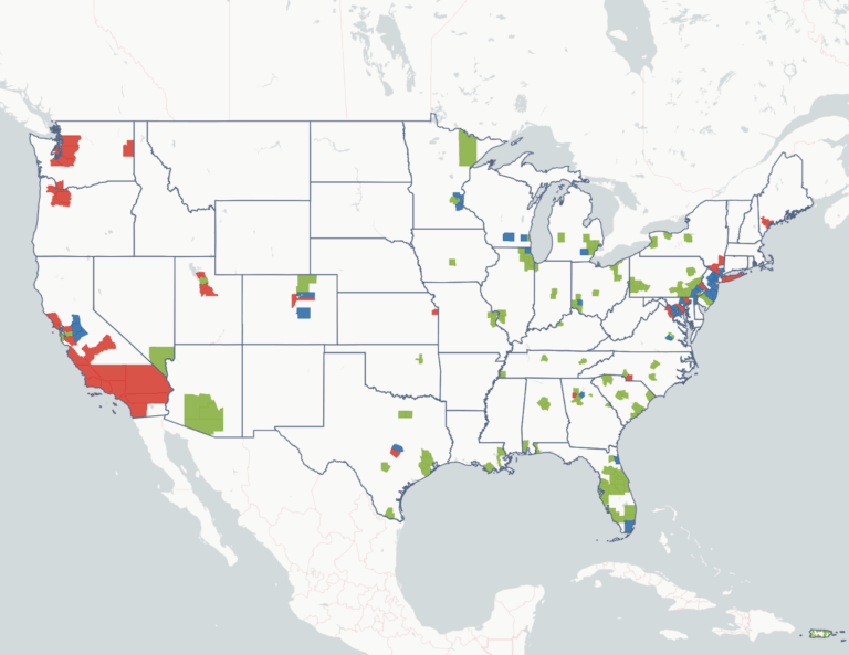
Across America’s cities and towns, how dense the place is predictive of how much residents drive.
Hover any city in the chart above to see its population, density, and modeled annual miles driven per person. A resident of Manhattan drives about 1,600 miles a year. A resident of Brookhaven, NY or Frisco, TX, drives close to five times more. Brooklyn, Jersey City, and San Francisco land exactly where you would expect given their density. Chicago, Washington DC, and Los Angeles cluster together in the 4,500 to 5,000 mile band despite being in very different regions with very different reputations for car culture.
The VMT figures are modeled by HUD’s Location Affordability Index v3, which predicts miles driven for a fixed household profile (a median-income, four-person, two-commuter family), calibrated on Illinois odometer data and validated nationally against the National Household Travel Survey.
Share the card: