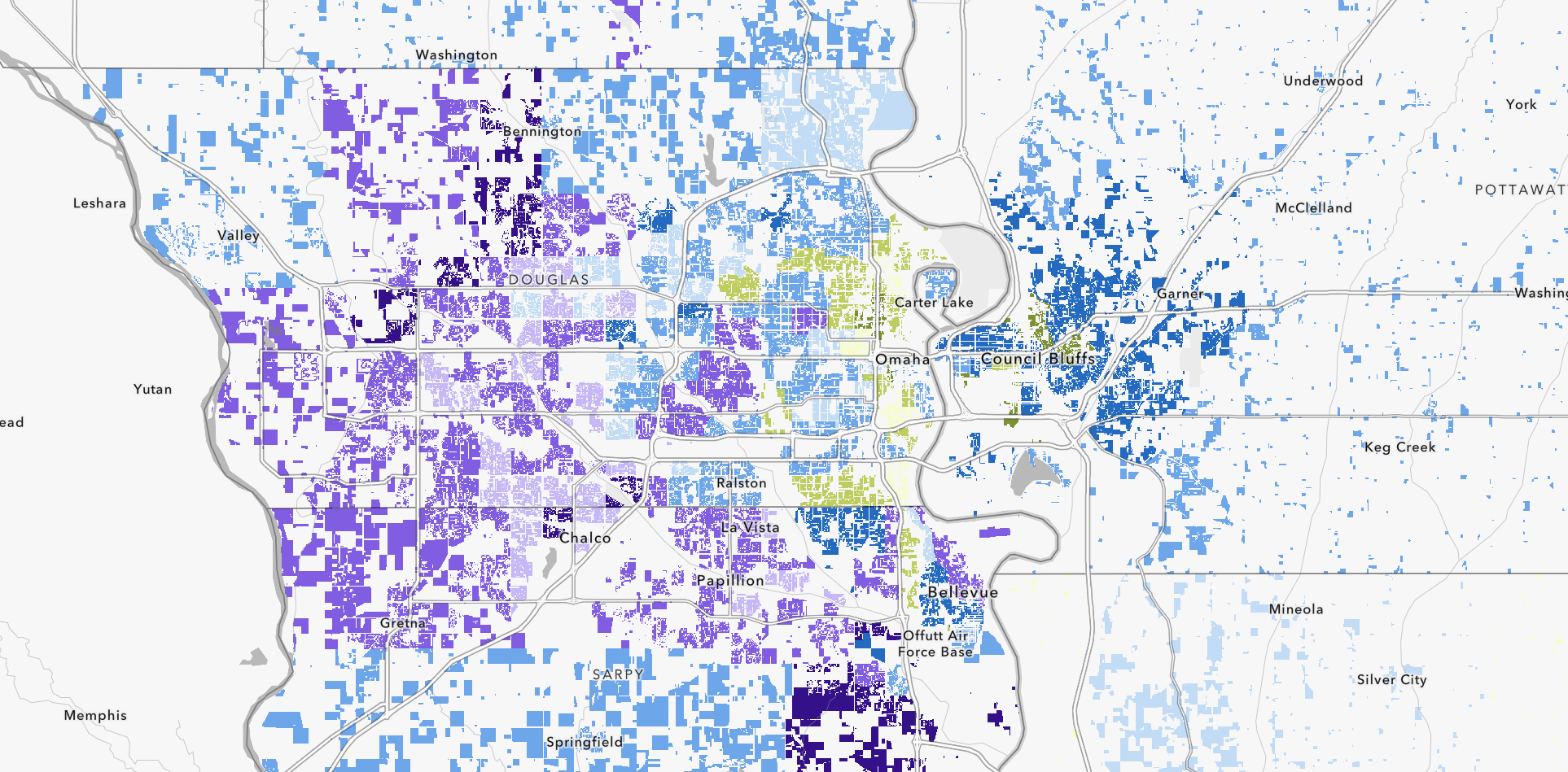
CommunityScale’s Housing Suitability Analysis helps regions and municipalities identify areas most appropriate for different types of housing development based on a comprehensive set of spatial and socioeconomic criteria. A GIS-based model is used to score and map locations using factors such as access to transit, infrastructure capacity, proximity to jobs and services, affordability considerations, environmental constraints, land availability, and zoning. The analysis incorporates both technical indicators and stakeholder-defined priorities, allowing for nuanced local interpretation. Results are visualized through interactive maps and integrated into an online dashboard that supports exploration and data download. The findings highlight opportunity areas for affordable, workforce, senior, and mixed-use housing and are designed to inform policy decisions without prescribing outcomes. This approach provides a transparent and flexible framework for aligning land use, housing, and transportation strategies.
Suitability analysis is particularly valuable for regional studies where multiple jurisdictions need a consistent, data-driven framework for identifying housing opportunity areas. The methodology draws on CommunityScale’s open source mapping tools and aligns with the growing focus on transportation-housing coordination at both the state and federal level.
Projects featuring housing suitability analysis:
- Affordable housing developable land analysis
- Central Massachusetts regional housing and transportation study
- Will County, IL housing study
- Catawba, SC regional workforce housing study
Related reading: